There are some places on earth where no human has ever set foot. The reason for certain parts of our planet remained untouched are wide and varied. The places in this list that either only a few people have gone or maybe even none at all.
Kamchatka, Russia
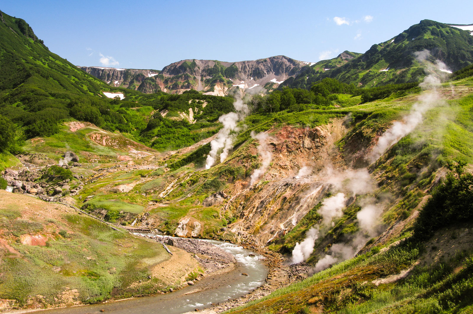
Russia’s Eastern Peninsula is home to some of the most spectacular volcanic activity on earth with more than 300 volcanoes including one that has been erupting continuously since 1996. It’s home to the most diverse range of salmon species and is the most densely populated brown bear habitat in the world. However, the region was closed to westerners until the collapse of the Soviet Union in 1991 and even before that only 400,000 people all with military clearances were allowed to live in the territory which is around the size of California.
Northern Patagonia, Chile
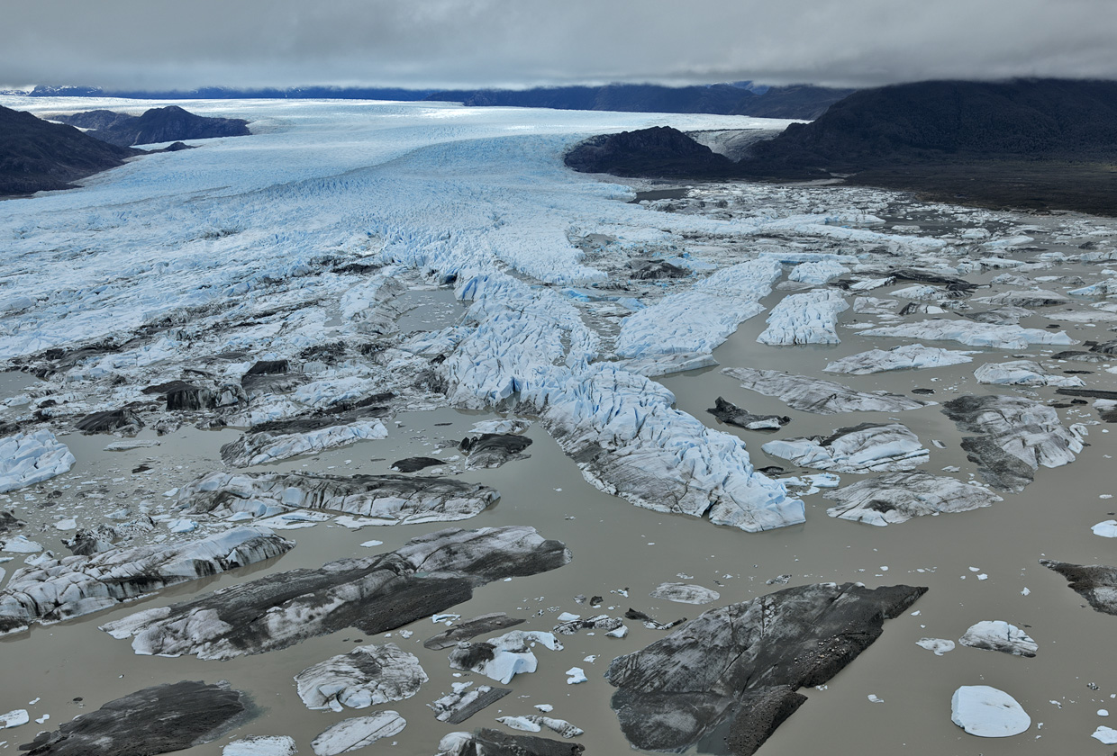
It’s home to temperate rain forests, glaciers, fjords, and hot springs. Northern Patagonia is one of Chile’s wildest landscapes. It’s the country’s most sparsely populated region and is only been accessible by highway since the 80’s. The northern Patagonia ice field remains one of the largest masses of ice outside the polar regions. Remarkably, few human beings have gone anywhere near it even fewer have had the chance to step out on to the infamous ice field for themselves.
Star Mountains
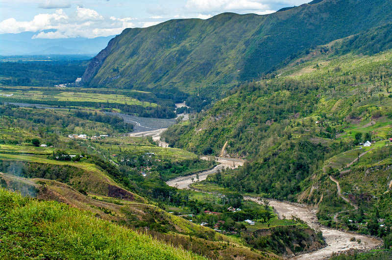
This remote region in western Papua New Guinea contains the Hindenburg wall, a limestone network of plateaus more than a mile high. The 30 mile long series of Bluffs features nearly undisturbed ecosystems high above the ground. A recent biological survey of the area found 1109 animal and plant species, almost 100 of which were new to science.
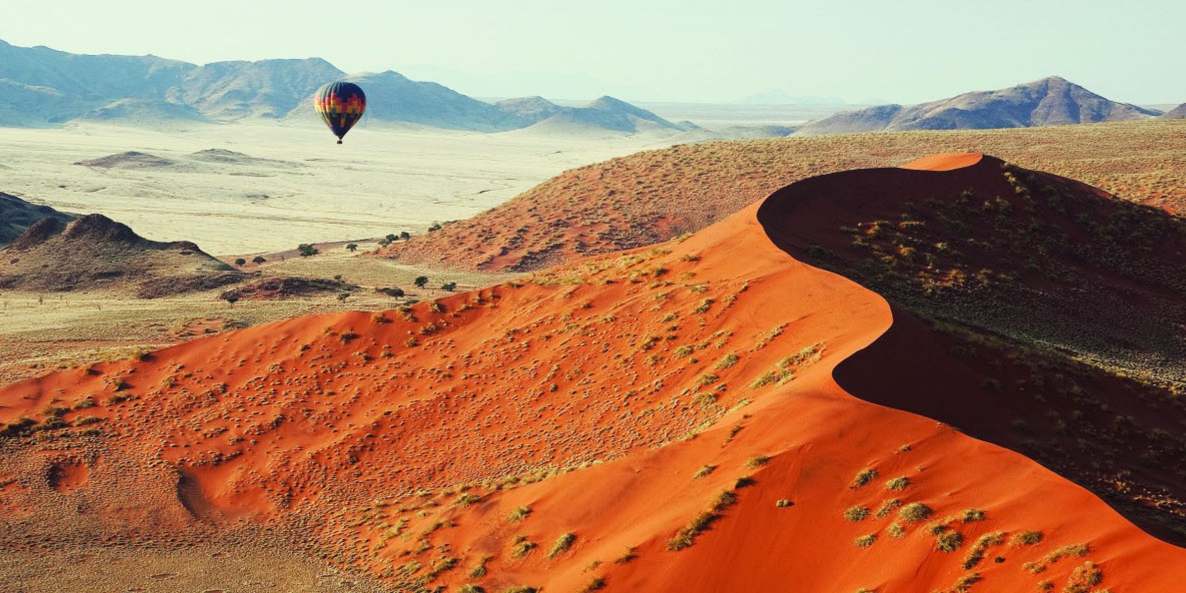
Southern Namibia
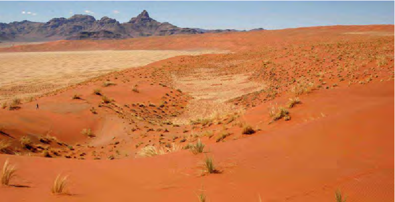
The Namib is estimated to be the world’s oldest desert and it’s one of the driest least populated places in the world. Dunes dominate the southern part of the harsh desert and there are few paved roads. At 1256 feet tall, the giant dune 7 is believed to be the tallest sand dune in the world.
Greenland
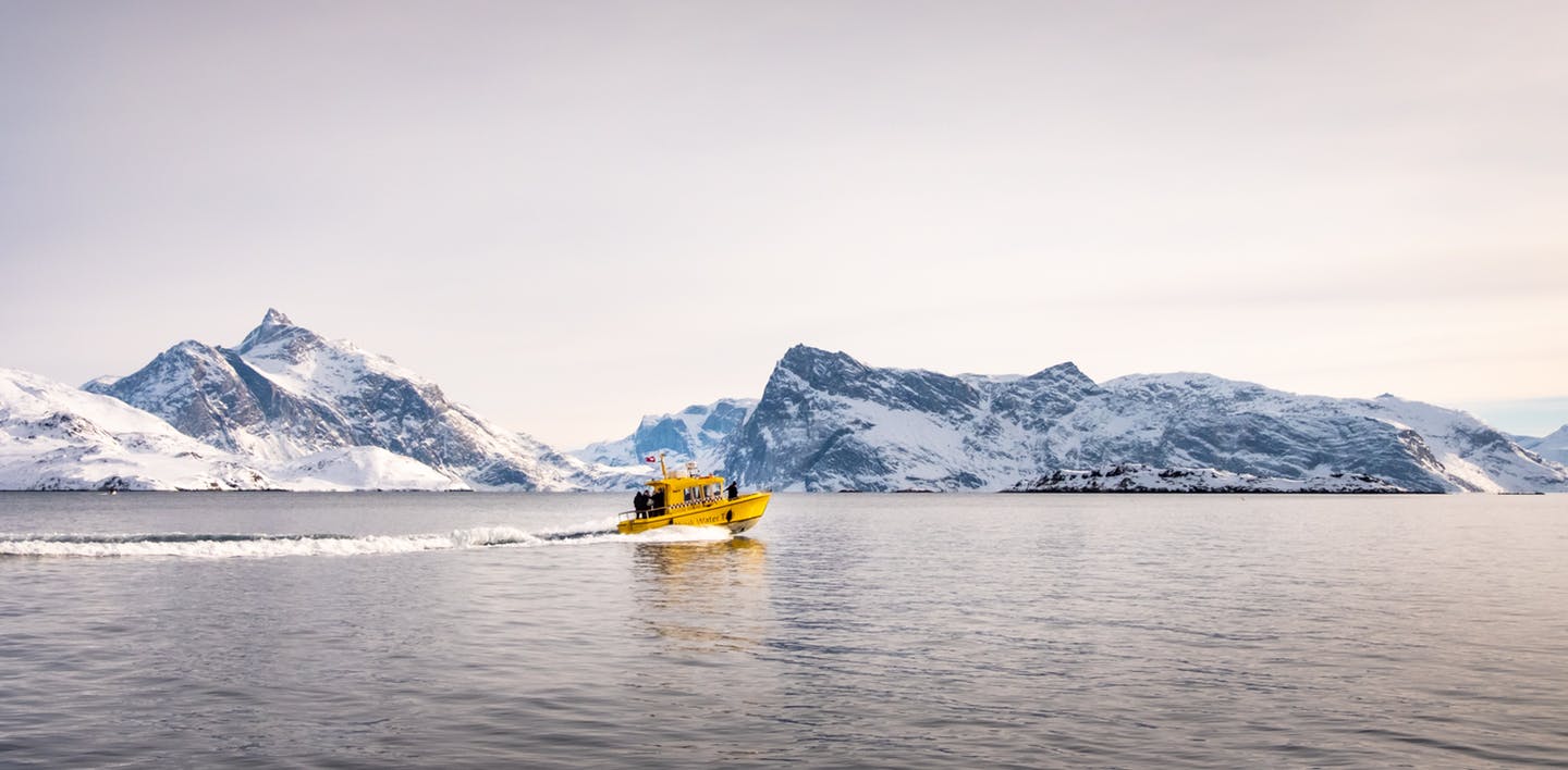
Though Vikings landed on Greenland around 1,000 CE we’re still discovering parts of the far northern region. Six new untouched islands off the coast were discovered as recently as 1999 and much of the inland part of the country is still uninhabited, some 80% of the island is covered by ice cap.
Siberian Sakha Republic
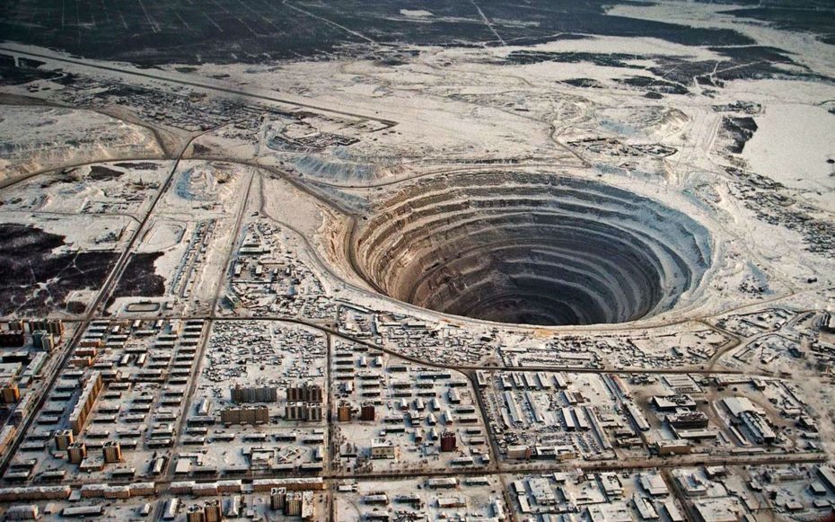
The Siberian Sakha Republic also called ‘Yakutia’, covers one-fifth of Russia about the same amount of land as India with a large swath of the territory located above the Arctic Circle. Its climate is one of the world’s most extreme, average temperatures in January are as low as (-46) degrees Fahrenheit and most of the land is covered by permafrost.
Lichen and moss make it a favorite habitat for reindeer. Though mining has taken its toll on the region’s pristine wilderness, parts of it remain untouched like the Lena River Delta, a gorgeous refuge and breeding ground for wildlife.
Mount Namuli, Mozambique
This eight thousand foot tall peak is the largest of a series of mounts that have developed much like separate islands with very different species making their homes on the different peace. Last year, a group of biologists and rock climbers teamed up to conduct fieldwork in the region where rock climbing is sometimes the only way to get at unexplored habitats.
Mountain Namuli was first explored in august 1886 by Henry Edward o Neill who was the British consul in Mozambique in 1879. It became notable in ornithological circles for the expedition by Hubert lynes and Jack Vincent in 1931 and 1932. Due to the Mozambican Civil War and poor road access, it was not until 1998 when a South African team of ornithologists were able to explore the forests of Mount Namuli.
Fioroland and National Park, New Zealand
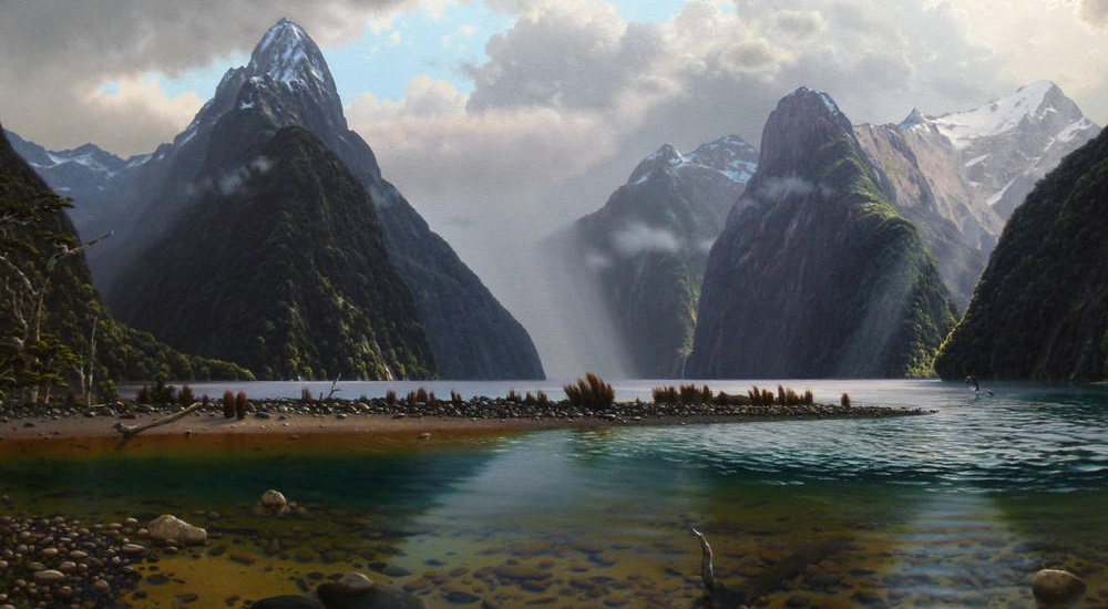
New Zealand’s largest National Park was shaped by glaciers and contains some of the country oldest rocks. The vast wilderness is home to a unique diversity of animals like the takahe, a flightless indigenous bird thought to be extinct for decades until it was rediscovered in the park in 1948 and the kekapo, the world’s only flightless nocturnal parrot. Fewer glance 2.9 million acres are some of the wildest lands in the southern hemisphere.
Cape Melville, Australia
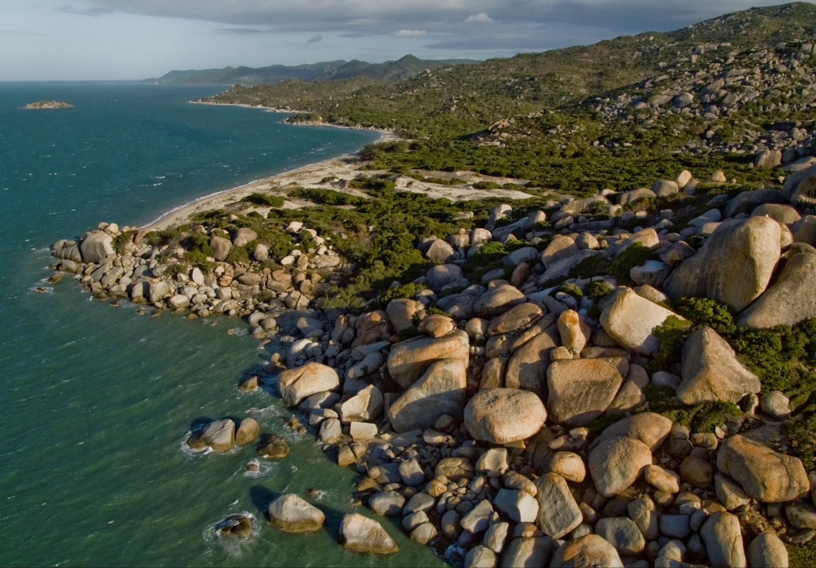
Walled off by forbidding granite boulders, piled hundreds of feet high Cape Melville is only around 900 miles from Brisbane, one of Australia’s biggest cities but the rain forest habitat might as well be a world away. Virtually inaccessible except by helicopter, scientists discovered three completely new species of animals in the area in 2013.
The Namib Desert
The Namib is a coastal desert in Southern Africa. The name Namib is of Khoekhoegowabo origin and means vast place. According to the broadest definition, the Namib stretches for more than 2,000 kilometers for 1,200 miles along the Atlantic coasts of Angola, Namibia, and South Africa.
Before the 20th century some people roamed the Namib, gathering edible plants on the shore, hunting in the interior, and drinking the juice of the tsama melon for water. Nowadays, some Herero still herd their livestock in the Kaokoveld than the Namib. A few Namakhoikhoi still grazed their livestock on the banks of the Kuiseb River in the desert. Most of the native people have left, however, leaving the vast majority of the desert uninhabited. The steps in the southern half of the desert are mostly made up of ranches run by Europeans who raise Karakul sheep with local help and send the wool of the lambs to Europe for use in fur coats.
Most of the rest of the desert is set aside for conservation, a vast portion of the desert called the Sperrgebiet was access restricted due to the presence of diamonds which are mined in the area at the mouth of the Orange River. Although the desert is largely unpopulated and inaccessible, there are year-round settlements at sesriem close to the famous Sossusvlel area and other small outposts in other locations.
In 2019, the namibian german artist Max Siedentope created an installation in the namib consisting of a ring of large white blocks, a top of which sat six speakers attached to a solar-powered mp3 player configured to continuously play the 1981 song Africa by the American band Toto. The exact location of the installation has not been disclosed.
Gangkhar Puensum
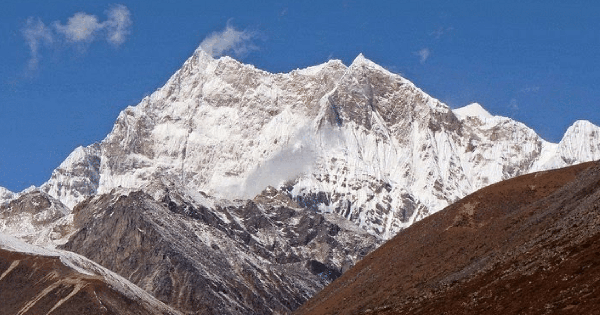
Gangkhar Puensum is the highest mountain in Bhutan and a strong candidate for the highest unclimbed mountain in the world with an elevation of 7,570 metres or 24,836 feet and a prominence of 2,995 meters or 9,826 feet, its name means white peak of the three spiritual brothers.
The elevation of Gangkhar Puensum was first measured in 1922 but until recent years, maps of the region were not at all accurate and the mountain was shown in different locations and with markedly different heights. Indeed, because of inadequate mapping the first team to attempt this summit was unable to find the mountain at all.
The book of the 1986 British expedition gives the mountains height as 24,770 feet or 7,550 meters and states that Gangkhar Puensum is completely inside Bhutan whereas the nearby Kula Kangry is completely inside Tibet. Kula Kangry 7,554 metres is a separate mountain 30 kilometers to the northeast which was first climbed in 1986. It is variously mapped and described as being in Tibet or Bhutan. Since 1994, climbing of mountains in Bhutan higher than 6000 metres has been prohibited out of respect for local spiritual beliefs and since 2003 mountaineering has been forbidden completely.
North Sentinel Island
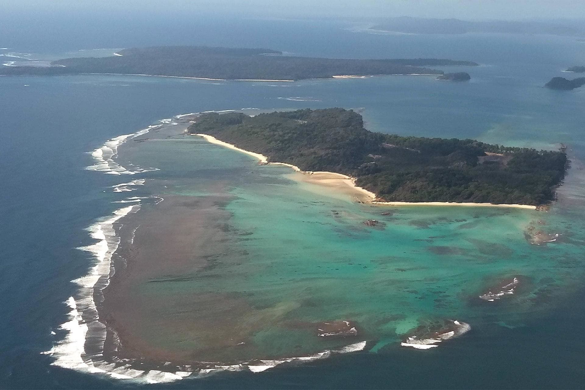
It’s located in the middle of the Bay of Bengal off the southernmost tip of Myanmar. North Sentinel island technically belongs to India but few outsiders have made contact with the Sentinelese people. There’s a three-mile exclusion zone surrounding the island where somewhere between 50-300 people are estimated to live. The locals hostile reactions to outsiders attempts at contact have left much of the island unexplored.
Vale Do Javari, Brazil
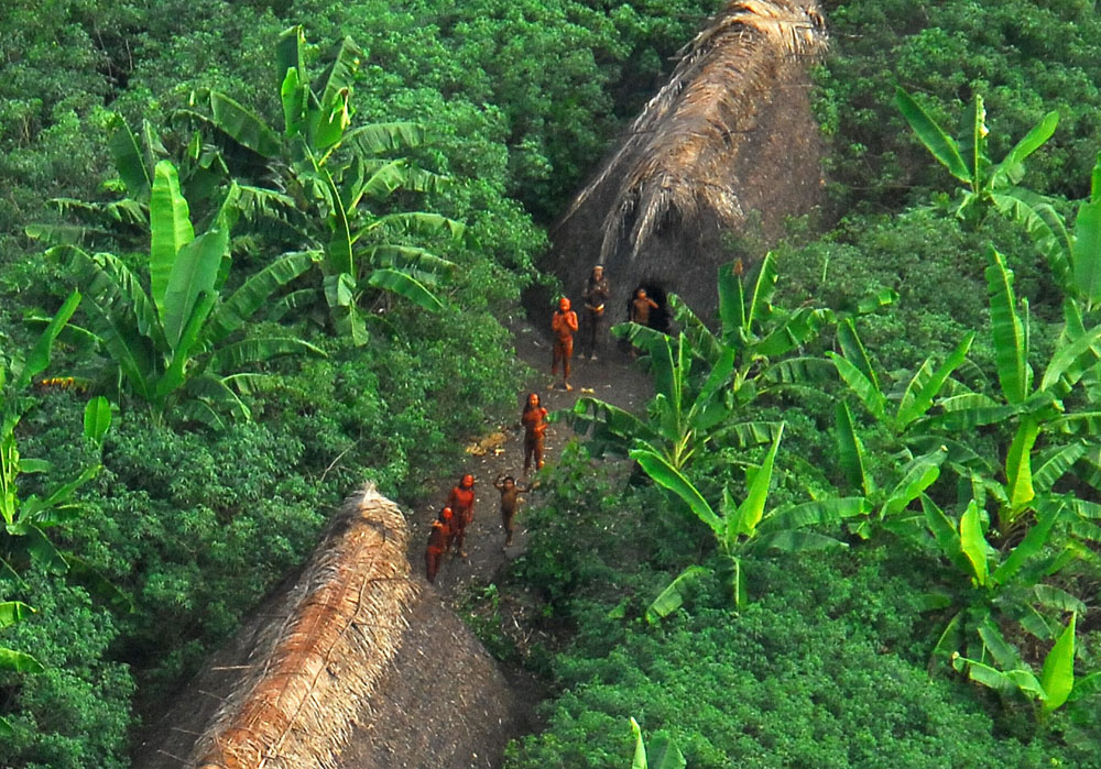
This region home to at least 14 of the Amazons uncontacted tribes and it is one of the most isolated places in the world in part by design. An estimated 2,000 indigenous people live autonomously from the Brazilian government in an area about the size of Austria. The tribes right to live in isolation is protected by a federal agency charged with preventing outsiders from invading indigenous territories.
It’s one of the largest indigenous territories in Brazil encompassing 85,444.82 kilometer squared or 32,990 miles squared or an area larger than Austria. It’s named after the Huaia River, the most important River of the region which since 1851 forms the border with Peru. It includes much of the Antalya municipality as well as adjacent territories in the western section of Amazon’s State.
Son Doong Cave, Vietnam
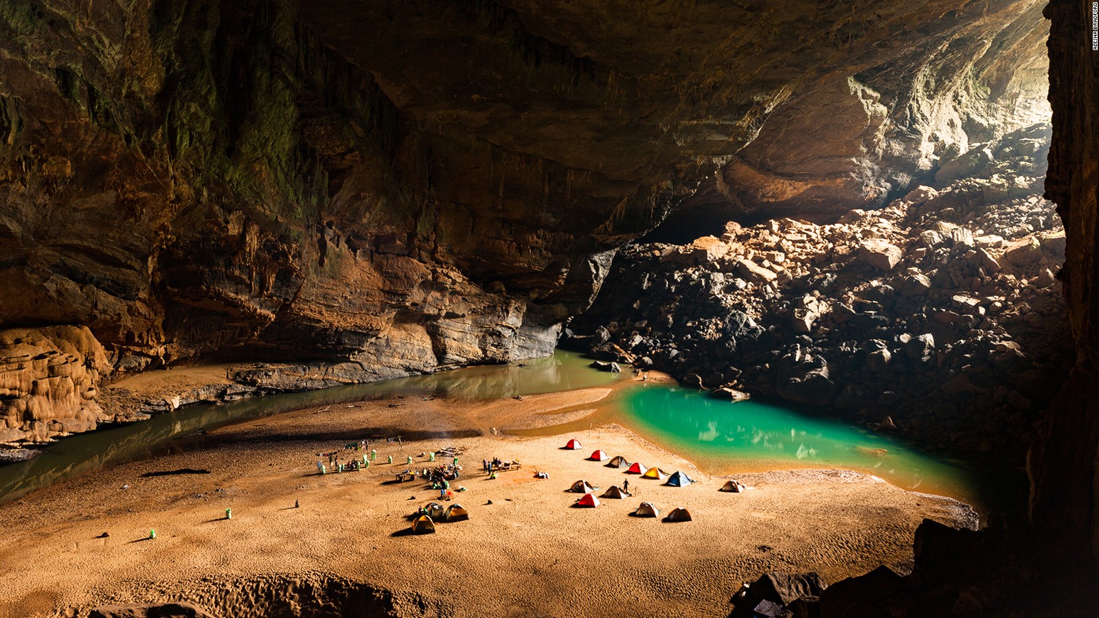
The world’s largest cave contains its own river and even a jungle and more than 5.5 miles long. The first expedition set off to explore this underground world in 2009 before being stymied by a 200 foot tall wall of calcite inside, much of the surrounding network of over 150 caves near the Laos border remains unsurveyed.
Plans are being considered to build a cable car through the cave. The proposed system would be 10.5 kilometres or 6.5 miles long and cost between 112 and 211 million dollars, the plans are opposed by environmentalists.
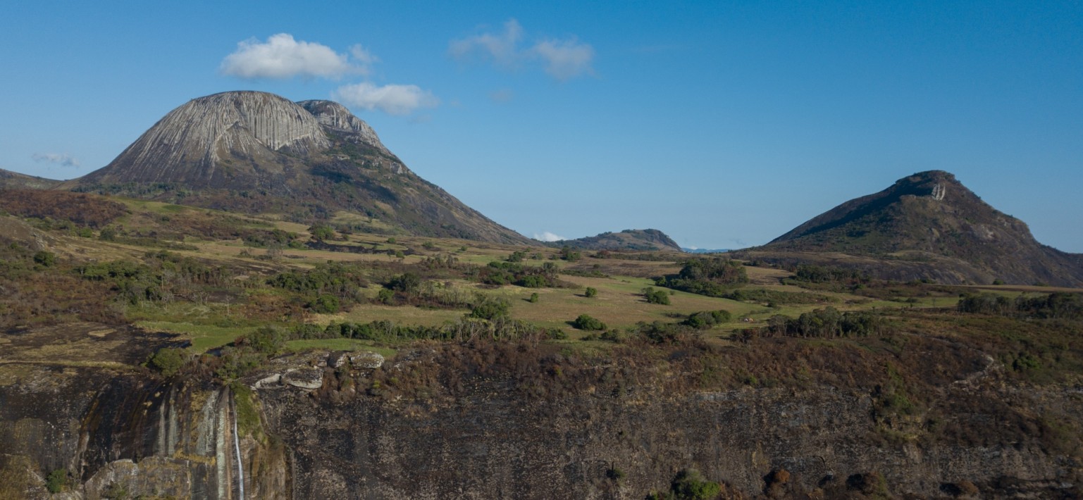
Tsingy De Bemaraha National Park
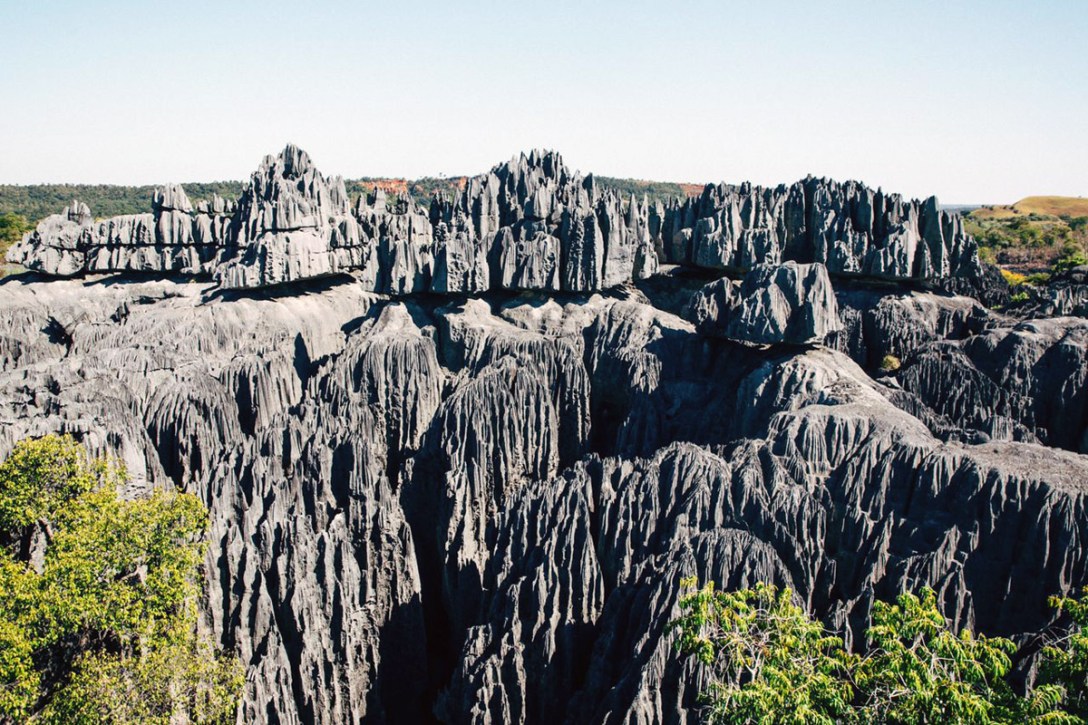
It’s named for the unique massive limestone formations known as tsingy, Malagasy for walking on tiptoes this 600 square mile National Park and wilderness preserve is located on Madagascar’s western edge. The needle shaped limestone was formed by erosion over a period of millions of years and the resulting habitat of gorgeous Canyon and forests is a natural fortress. A huge number of species of plants and animals are endemic to the region, it means they’re not found anywhere else on earth and there are plenty that haven’t been discovered yet. While its southern tip is open to the public much of the reserve is off-limits to tourists.